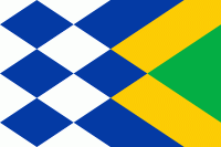
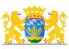
Korendijk (Gemeente Korendijk)
 |
 |
With the municipal reorganization of the Hoeksche Waard on 1 January 1984, the municipality of Korendijk was formed out of the former municipalities of Goudswaard, Nieuw-Beijerland, Piershil (location of town hall), Zuid-Beijerland, and the island Tiengemeten. In addition to these villages, it also had the population centres Nieuwendijk and Zuidzijde. On 1 January 2019, it merged into the municipality of Hoeksche Waard.
The municipality of Korendijk was bordered on the southside by the Haringvliet estuary, on the westside by the Spui River, and by the municipalities Oud-Beijerland and Cromstrijen to the north and east.
Dutch Topographic map of the municipality of Korendijk, June 2015
Map - Korendijk (Gemeente Korendijk)
Map


Country - Netherlands
 |
 |
The four largest cities in the Netherlands are Amsterdam, Rotterdam, The Hague and Utrecht. Amsterdam is the country's most populous city and the nominal capital. The Hague holds the seat of the States General, Cabinet and Supreme Court. The Port of Rotterdam is the busiest seaport in Europe. Schiphol is the busiest airport in the Netherlands, and the third busiest in Europe. The Netherlands is a founding member of the European Union, Eurozone, G10, NATO, OECD, and WTO, as well as a part of the Schengen Area and the trilateral Benelux Union. It hosts several intergovernmental organisations and international courts, many of which are centred in The Hague.
Currency / Language
| ISO | Currency | Symbol | Significant figures |
|---|---|---|---|
| EUR | Euro | € | 2 |
| ISO | Language |
|---|---|
| NL | Dutch language |
| FY | West Frisian language |